
TURNKEY AERIAL INTELLIGENCE,
ANYWHERE, ANYTIME
From flight to insight, we deliver the ground truth about your assets at scale —so you can act with confidence when it matters most.
LAUNCH CAMPAIGNTrusted by
How It Works
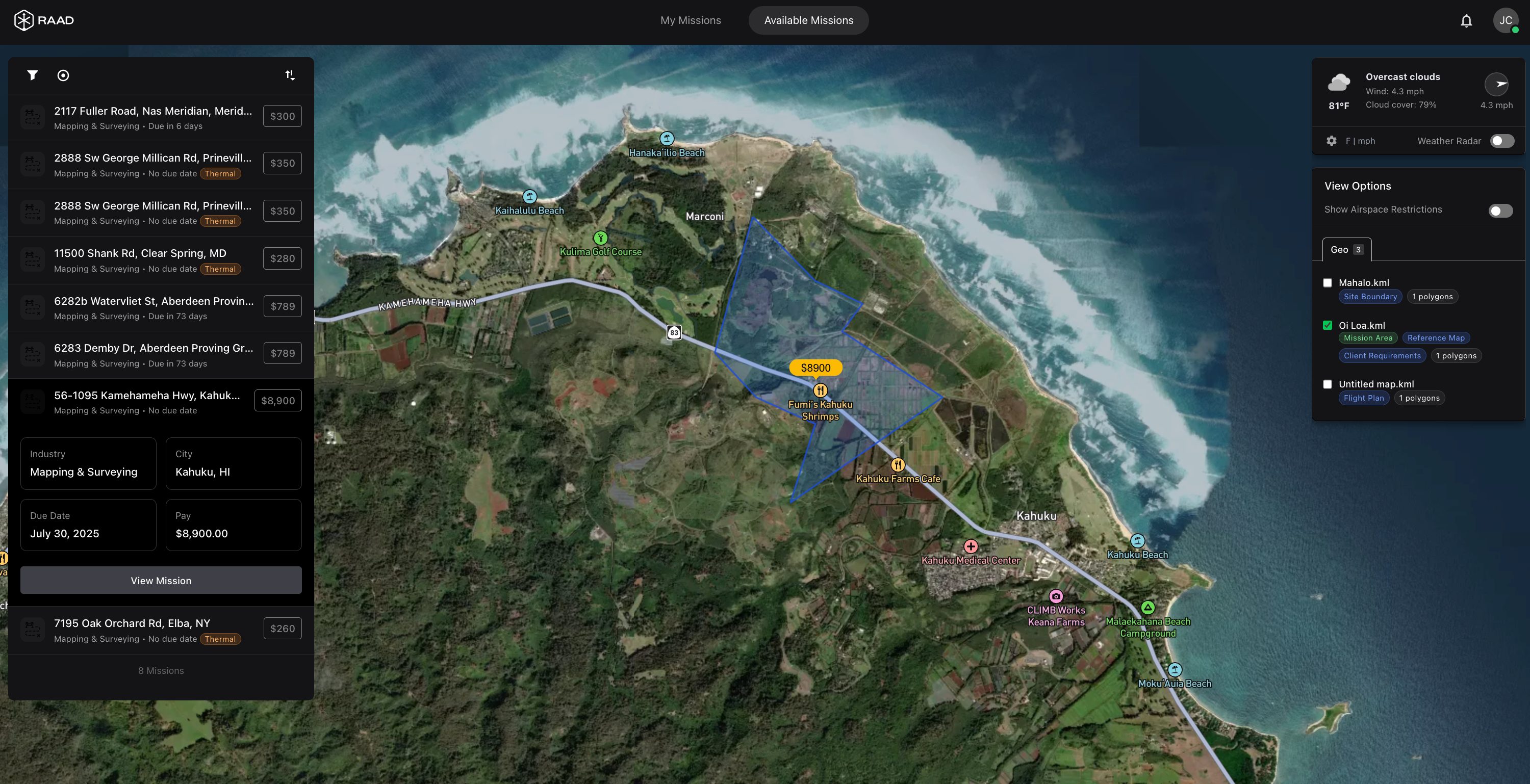
Select Sites to Capture
Select properties or assets directly on a map, paste a list of addresses, upload coordinates, or drop in a KML. We validate locations and flight permissions in seconds.
Scope Campaign Parameters & Budget
Choose deliverables (orthomosaic, 3D model, thermal, LiDAR, video), set timelines and SLAs, and define your target budget. Raad matches and dispatches the right pilots automatically.
Receive QC'd Data in Your Portal
Sit back while Raad dispatches pilots, collects imagery, runs quality control, and delivers results to your dashboard — complete with notifications when ready.
Ready to start? Launch your first mission today.
LAUNCH CAMPAIGNIndustry-Specific
Solutions
On-demand aerial intelligence
for construction
The #1 reason construction projects slip - bad site data. Raad is a turnkey solution for aerial documentation. From construction progress updates to LiDAR topography to stockpile volumetrics, Raad has you covered.
EXPLORE CONSTRUCTION CAPABILITIES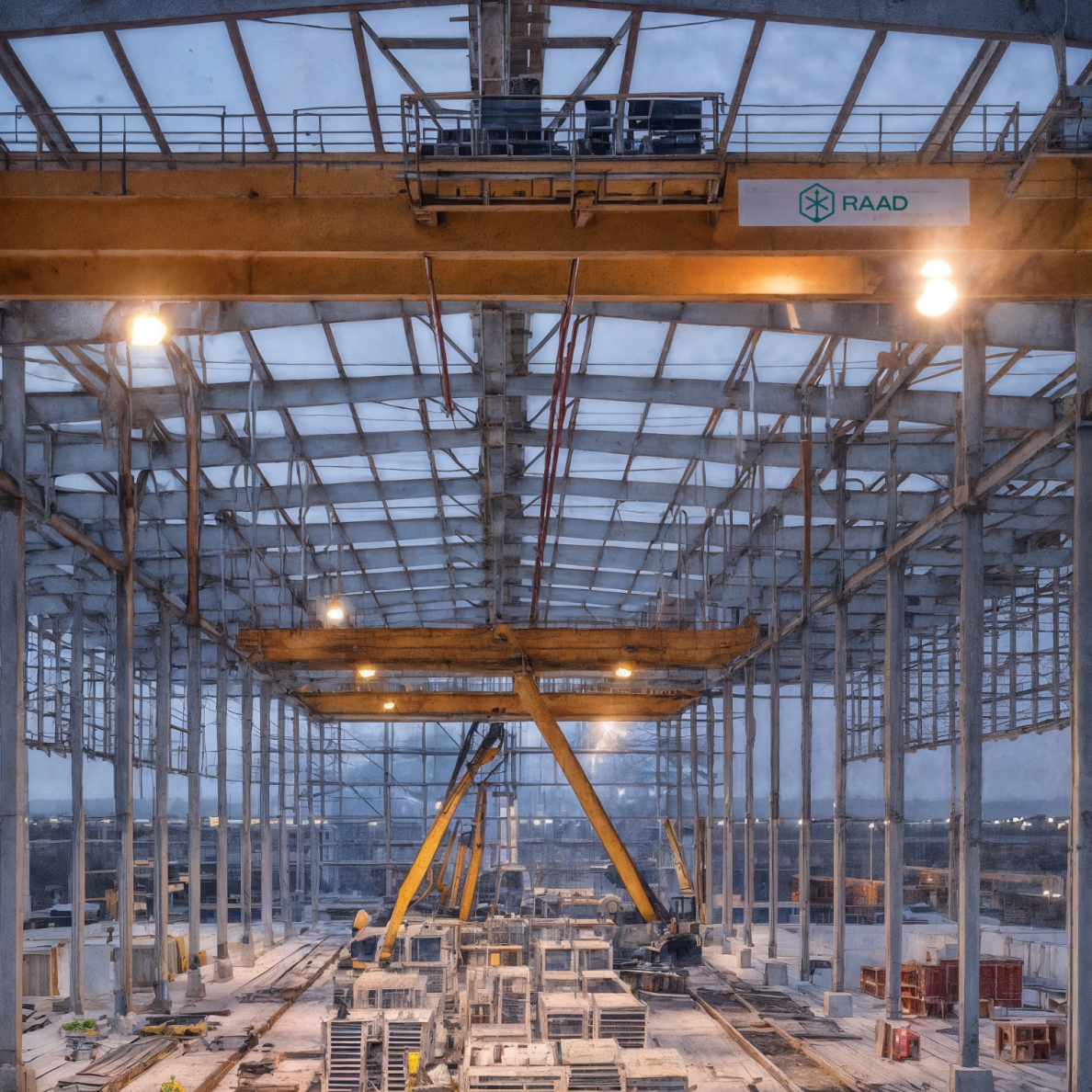
Enhance Utility
Infrastructure Management
& Reliability
Monitor transmission & distribution assets in high-resolution, prevent catastrophe risk, eliminate truck rolls, and lower SAIFI/SAIDI. Raad standardizes mega-scale pilot coordination and data capture to monitor for insulator damage, power line sag, pole health, and vegetation encroachment.
VIEW UTILITIES CAPABILITIES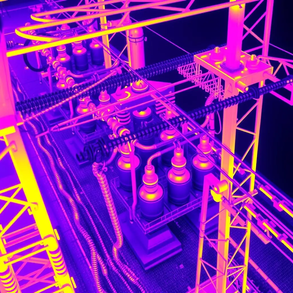
Advanced Aerial Solutions for Communications Networks
Simplify telecoms and fiber infrastructure monitoring with Raad's standardized solutions. Our pilots deliver precision tower inspections, civil surveys, line-of-sight verification, and damage reports.
VIEW TELECOM SOLUTIONS
Aerial Intelligence Across Solar Lifecycle
From site scouting to commissioning to O&M, Raad delivers fast, high-resolution imagery and analysis to accelerate development, verify builds, and keep assets performing. —Detect defects. Monitor progress. Maximize yield.
EXPLORE SOLAR SOLUTIONS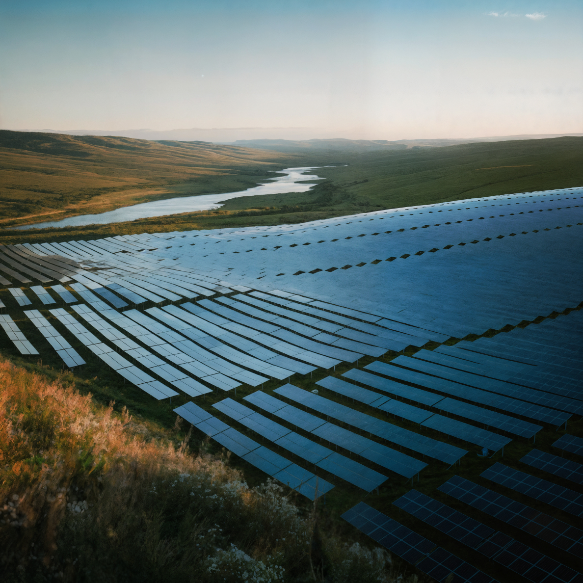
Showcase and Inspect Properties Effectively
Differentiate your marketing materials and streamline facade and roof inspections with cinematic and thermal capture. Our pilots specialize in highlighting property features, site context, roof and facade conditions, and infrastructure access critical for commercial, industrial, and residential properties.
ELEVATE YOUR PROPERTY SERVICES
Accelerate Claims and Underwriting with Aerial Data
Improve accuracy, reduce fraud, and accelerate insurance claims processing and risk assessment. Our network provides rapid deployment for detailed property damage assessment (roofs, exteriors), pre-underwriting inspections, and large-scale catastrophe event documentation.
EXPLORE INSURANCE SOLUTIONS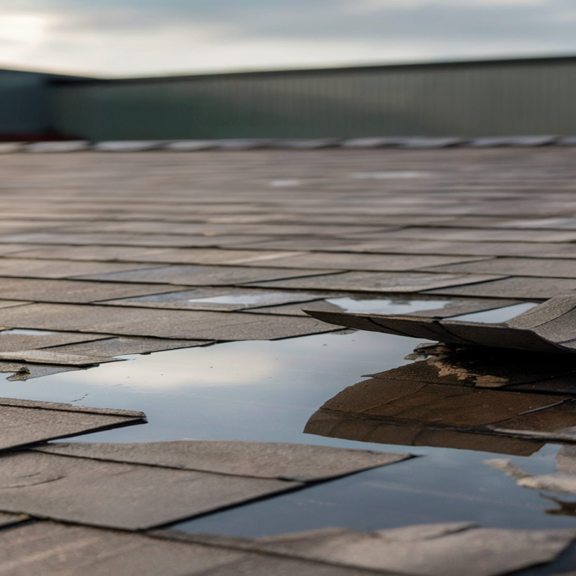
CASE
STUDIES
Real-world examples of how Raad delivers turnkey aerial intelligence solutions at scale across the United States.

Dallas–Fort Worth: 100 Drone Rooftop Thermal Inspections
This case study details how Raad successfully completed 100 drone rooftop thermal inspections in Dallas–Fort Worth, involving 200 flights (daytime RGB and nighttime thermal) within weeks. The solution leveraged Raad's network of over 2,000 US pilots, including 100+ in DFW, to quickly assign missions to local, qualified operators, eliminating travel costs and logistical overhead.
Read Case Study →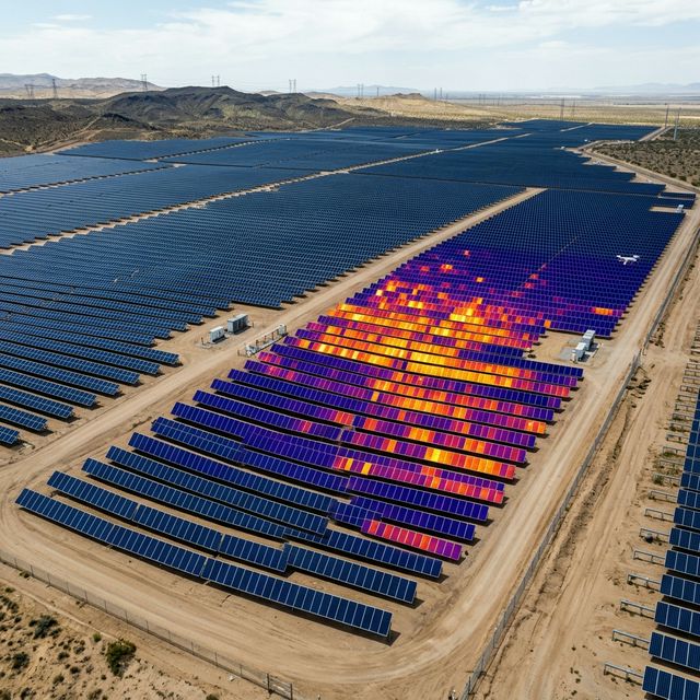
55 Solar Thermography Inspections Missions - Minnesota
This case study details how Raad successfully completed 55 commercial solar array inspections in Minnesota in under two weeks. The client, a large solar technology company, required infrared inspections under specific conditions, including high solar irradiance and real-time panel tilting. Raad's solution involved using its platform to manage sites, scheduling flights during optimal weather conditions.
Read Case Study →NATIONWIDE
COVERAGE
Access our network of specialized drone pilots across the United States. No matter where your project is located, we have certified professionals ready to deliver consistent, high-quality aerial intelligence.
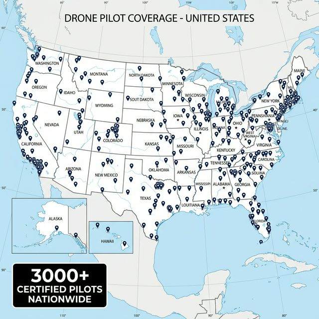
Fast Response Times
Deploy pilots to your project location within 24-48 hours, even rural areas.
Consistent Quality
Standardized equipment, protocols, and deliverables across our entire network.
Local Expertise
Pilots familiar with regional regulations, weather patterns, and terrain challenges.
Why Industry Leaders
Choose RAAD
Nationwide Coverage
Access qualified pilots anywhere your projects take you, with consistent quality standards and deliverables.
Specialized Expertise
Match with pilots experienced in your specific industry requirements and technical specifications.
Enterprise-Grade Security
Every pilot follows strict protocols for sensitive sites and data handling.
Standardized Deliverables
Receive professionally processed data in your preferred formats, ready for immediate use.
Scalable Capacity
Quickly deploy multiple pilots across various locations for time-sensitive or large-scale projects.
Enhance Your Analytics With Aerial Data Integration
Partner with Raad to offer your clients comprehensive aerial intelligence that enhances your analysis and recommendations. Our certified pilots capture precisely the data formats your systems require—from agricultural performance metrics to volumetric measurements—for seamless integration with your existing analytics platforms.
EXPLORE DATA SOLUTIONS
Simple Process
Powerful Results
Define
Requirements
Specify your project needs, locations, timeline, and deliverable formats.
Review
Matches
We identify qualified pilots with the right equipment and experience.
Approve and
Deploy
Select your preferred pilots and confirm mission parameters.
Receive
Deliverables
Get processed, analysis-ready data through our secure portal.
Integrate and
Analyze
Seamlessly incorporate visual data into your existing workflows.

Certified Professional Drone Pilots
Every pilot in our network undergoes rigorous verification of certifications, insurance coverage, equipment maintenance, and operational procedures. Our ongoing quality assurance ensures consistent deliverables regardless of project location.
Pilot Qualifications
FAA Part 107
Certification
Commercial drone operation certification required for all professional pilots
Specialized
Waivers
Night operations, flying over people, and other special authorizations
Industry
Training
Specialized training for specific industries and operations
GET STARTED
Sign up to start your first campaign and see the difference Raad can make.
SCHEDULE CALL